SALT CREEK

JULY 2017

ALL-AMERICAN MAN PICTOGRAPH AND DWELLING

ALL-AMERICAN MAN PETROGLYPH

WEDDING RING ARCH

FOUR FACES PICTOGRAPH

FOUR FACES PICTOGRAPH AND DWELLING

FOUR FACES DWELLING

KIRKS ARCH

GRANARY AND A STILL PRODUCTIVE SQUASH PATCH

GRANARIES NEAR THE SQUASH PATCH

BIG RUIN

NEWSPAPER ROCK

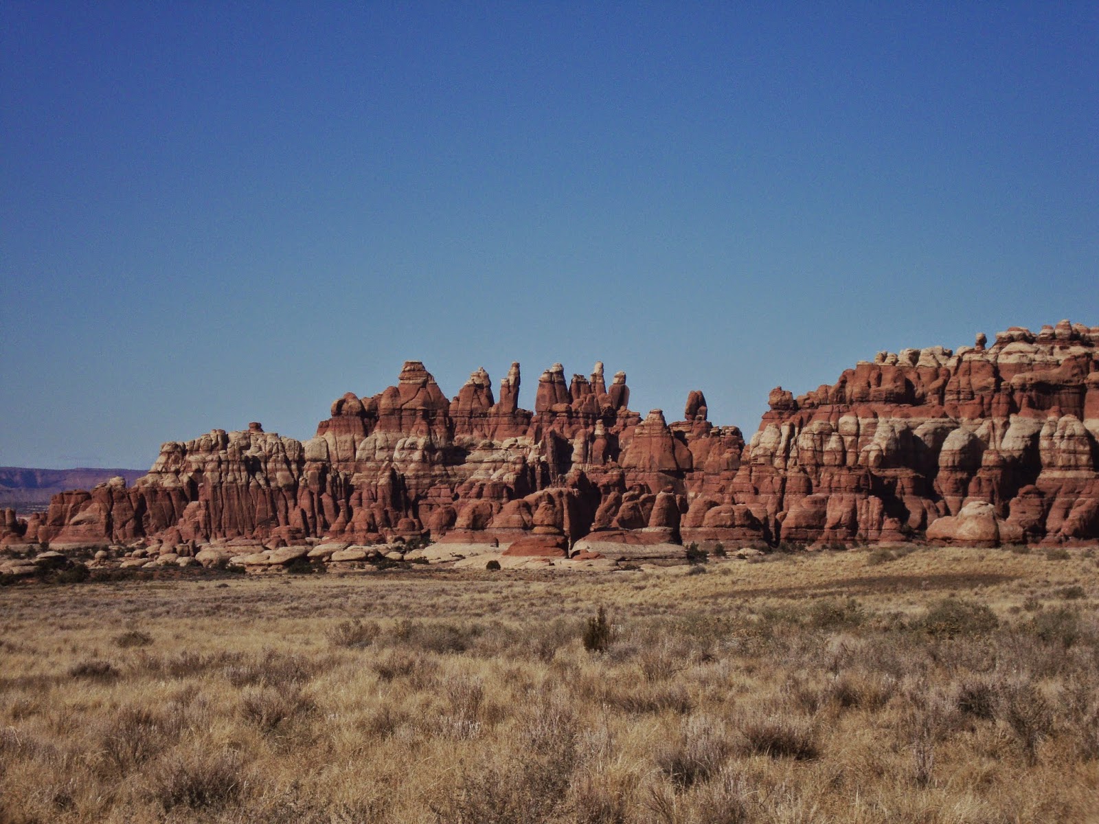
Salt Creek is a very impressive 19-mile roundtrip hike located near the Needles District which I had never heard of until just a few months prior to visiting in July, 2017. I happened to be in Southern Utah on a Fourth of July weekend, and so I wanted to find a less-popular hike in order to beat the holiday crowds. Salt Creek was perfect, as I had the area entirely to myself. The road to the trailhead was not too rocky, but there were some long sandy sections you will need to be careful on. The trailhead isn't marked, so bring detailed directions. 

The trail drops steeply down into the canyon below just past the trailhead. A little after reaching the bottom of the canyon, the trail will fade as you enter a large marshy area overgrown with grasses, rushes and tamarisk trees. You will forget you are in the desert here, as you will be completely immersed in the thick trees, not being able to see very far in any direction. As I was hiking alone, and there was a "Beware of Bears" signs at the trailhead, I got a little nervous in this section as there was bear scat all along the makeshift trail through the marsh.

Eventually the marsh will end and you will enter back into open desert at Kirk's Cabin. There are some ruins a little past Kirk's Cabin, and just past the ruins Kirks Arch will come into view. A little further down the trail there will be 0.8-mile roundtrip spur trail leading to Big Ruin, which is definitely worth your time. As I was day-hiking in some brutal heat, I chose to skip the spur trail to the Big Pocket Ruins to make sure I had the time and energy to make it to the Four Faces Pictograph. 

A little past the Big Ruin spur trail there will be a side trail leading to Wedding Ring Arch which is definitely worth your time. A little past Wedding Ring Arch you will see a spur trail leading to some granaries and a squash patch, that is thought to have been planted by the Ancestral Pueblo. Further down the trail you will see a dwelling up in an alcove and then the iconic All-American Man Pictograph. The trail will then take you through a crack between some sandstone cliffs and then drop you into a thick, overgrown marsh with very limited visibility.  

Just after exiting the marsh you will come to the Four Faces Pictograph and associated ruins. This area was very impressive. There is also a pond located not too far from the ruins which I was surprised to find salamanders swimming in. It was a beautiful hike, though I may have overestimated my abilities slightly. The heat got to me by the end, and I really struggled making it back up the long steep climb out of the canyon. By the end I was completely out of water and was stopping to rest every couple minutes. While it would be much more pleasant to hike in the Spring or Fall, hiking it in Summer will give you solitude. If I were to do it again, I would either not go quite so far, or backpack it so I could take my time. If you do backpack, you will need to reserve your spot ahead of time with the National Park Service as there are only a few designated sites where it is permitted in the canyon.       

BLUE JOHN

MARCH 2013 & JULY 2017

ENTERING THE CATHEDRAL

FIRST RAPPEL IN THE MIDDLE FORK

THE DROP INTO MIDDLE BLUE JOHN

DESCENT INTO MIDDLE BLUE JOHN

ALONG THE DESCENT INTO MIDDLE JOHN

BLUE JOHN NARROWS

BLUE JOHN NARROWS

MIDDLE FORK OF BLUE JOHN

NARROWS SECTION

THE CATHEDRAL


MIDDLE BLUE JOHN OPENING BACK UP

MOTEL 6 NEAR THE TRAILHEAD

SAND DUNES ALONG THE DRIVE TO THE TRAILHEAD

The Blue John network of canyons are located on BLM, not too far from the Horseshoe Canyon Unit of Canyonlands National Park. To get to the trailhead, you will travel about 30 miles down a dirt road off of State Highway 26 just across the street from the turn-off for Goblin Valley. The road is not too bad, but there are a couple long sandy sections you will need to be careful on. I began my hike at the Granary Springs Trailhead, which includes the iconic Motel 6. 

On my first trip to Blue John in 2013, I brought a rope and rappelled down the steep drop into the narrows section of Middle Fork just to be safe. However, when I returned in 2017, I was able to safely squeeze my way down to the narrows section without a rope. The canyon walls are so close together on the descent that you can press yourself against both sides of the canyon to slow yourself down and as you drop to the bottom of the canyon. 

Just after arriving at the bottom, you will enter a really nice, tight narrows section known as The Cathedral. The canyon walls are so tall and narrow, that it feels like you are walking in a cave. Because it is so dark, it is hard to get a good photo of this section. There are no obstacles or difficult sections in the narrows, just a very pleasant walk down a cave-like canyon. The first time I hiked the Middle Fork I exited out the West Fork. As the West Fork is not a very interesting section, I took an earlier exit on my return trip located on the left side of the canyon. It is also possible to backtrack up Middle Fork and climb back out where you dropped in, but I decided to play it safe, as I've read it could be difficult climbing out solo.  

When I hiked this area in March, 2013, I saw several other hikers along the way, but when I returned in July, 2017, I had the entire area to myself. If you can take the heat, summer can be a good time to get some solitude in Southern Utah. I remember the first time I visited, one of my tires went flat while I was camped at the Granary Springs Trailhead. I only had a doughnut as a spare, so by the time I got to Green River the spare had gone flat. Being a Sunday, All of the tire/auto repair shops were closed, except for one semi truck shop that was kind enough to patch my tire and get me back on my way. 


CHESLER PARK

NOVEMBER 2011 & FEBRUARY 2018

CHESLER PARK

JOINT TRAIL

JOINT TRAIL

CHESLER PARK

CHESLER PARK

CHESLER PARK

CHESLER PARK

CHESLER PARK

CHESLER PARK

Chesler Park is a scenic section of the Needles District which I accessed from the Elephant Hill Trailhead. I decided to combine Chesler Park with Druid Arch for a nice 14-mile hike loop hike through The Needles. The Needles District is a maze of many inter-connected trails, so you have a lot of options when hiking here. 

While the whole area is nice, my favorite part was the Joint Trail. These are some long narrow hallways that can require squeezing to get though in some parts. I was here on a beautiful November day in 2011, and only saw about 10 other people on my hike. A very relaxing place.

DRUID ARCH

NOVEMBER 2011

DRUID ARCH

DRUID ARCH

NARROWS SECTION

SLOT CANYON BETWEEN DRUID ARCH AND CHESLER PARK

CANYON BETWEEN DRUID ARCH AND CHESLER PARK

Druid Arch is a very peaceful 10.5-mile round-trip hike within the Needles District of Canyonlands National Park. I remember seeing only a couple people on my way to the arch in November of 2011. After visiting Druid Arch, I decided to also visit Chesler Park before returning to the Elephant Hill Trailhead as it was not too far out of the way.  

HORSESHOE CANYON

MAY 2009

THE HOLY GHOST IN THE GALLERY

HORSESHOE CANYON TRAIL

THE GALLERY

SANDY TRAIL THROUGH HORSESHOE CANYON

Horseshoe Canyon belongs to Canyonlands National Park as a detached island located near the Maze District. To reach the trailhead you will take a dirt road coming east off of State Highway 26, just across the street from the road to Goblin Valley. The road is not too bad, but there is a long sandy section you will need to be careful on. 

The hike from the trailhead to the gallery is about three miles. The trail begins with a steep descent into the canyon from the parking area above. This is a very beautiful canyon with a soft, sandy path leading between red rock walls the entire way. Its only a six-mile round trip hike to The Gallery, but walking on the loose sand will slow you down.

You will pass two or three rock art sites before reaching The Gallery. There are side trails leading to them and they are not hard to find since the canyon is so narrow. The main destination on this hike is The Gallery, which is a large wall filled with many large pictographs. When I was there in May of 2009, there were two sets of binoculars located in metal boxes below the wall to allow you to see the art in more detail. I hiked this trail in the evening, and remember seeing a couple people towards the beginning of the hike, and then having the entire canyon to myself. I must have started fairly late, as I can remember rushing to make it back out of the canyon and to my car before it got too dark.   

DEVILS KITCHEN

FEBRUARY 2010

TRAIL LEADING INTO THE KITCHEN

NARROWS SECTION

LOOKING TOWARDS THE KITCHEN

DEVILS KITCHEN AREA FROM AFAR

Devils Kitchen is a beautiful loop hike through the Needles District of Canyonlands National Park. The best place to begin this hike is the Elephant Hill Trailhead. However, because I was hiking in February, the dirt road to Elephant Hill was too snowy and muddy for my vehicle. So instead I began my hike from the Squaw Flat Trailhead, which added about two miles to the hike.

I had originally planned to hike to Chesler Park. However, once I got to the trail junction forcing me to choose between Chesler Park and Devils Kitchen, I ended up choosing Devils Kitchen due to the amazing rock formations I saw in that direction. The Devils Kitchen Loop felt very intimate, as you get to walk among the rock spires.

The only life I saw on my hike were ravens, until I bumped into two hikers near the trailhead on my way back. They were the only people I saw in two days of hiking the Needles. While hiking the Needles in February provides solitude, it can also make for some dangerous conditions. When slick rock gets covered with snow and ice, it becomes especially slick. Luckily there were no major climbs on this trail.

The amount of trail intersection in the Needles District can be overwhelming. You have the option of switching trails about every mile or two. Because of the many inter-connecting trails, the Needles would make a great place to backpack. 

BIG SPRING CANYON

FEBRUARY 2010

TRAIL JUNCTION AT THE END OF SQUAW CANYON

VIEW NEAR THE END OF SQUAW CANYON

VIEW FROM THE TOP OF BIG SPRING CANYON

SNOW DESCENT INTO BIG SPRING CANYON

I arrived at the Needles District of Canyonlands in the first week of February about four hours before sunset. Playing it safe, I decided to do the shortest hike from the Squaw Flat Trailhead, which happened to be the Squaw Canyon Big Spring Canyon Loop Hike. While it was a pleasant walk with nice views, it is not nearly as interesting as the other hikes in the Needles, such as Druid Arch, Devils Kitchen and Chesler Park.

Hiking this trail in the winter was a little rough as there was a steep climb required to get out of Squaw Canyon which was covered in ice, and a big, steep drop into Big Spring Canyon which was covered with a layer of icy snow. This section had me really nervous. However, if you were to hike this trail after the snow has melted, these sections would not be a problem.

The nice thing about hiking the Needles the first week of February is that you have the place almost entirely to yourself. I hiked over twenty miles in two days, and saw only two people the entire time I was there. The only other sign of life were several large ravens who followed me around while I hiked.